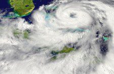
If you live in Berkeley County, you better keep your umbrella handy. Rain is in the forecast now that Arthur is a hurricane.
Mike Emlaw with the National Weather Service says that Arthur was located about 110 miles southeast of Charleston at 5 AM and was moving north at 9 mph, although recently the motion was becoming more NNE. The center of Arthur can be easily seen on our radar.
He added that maximum sustained winds were at 75 mph with higher gusts. The National Weather Service is reporting that Arthur is expected to gradually track more northeastward with time today, keeping Arthur east of the Georgia and South Carolina coasts.
“This will keep us on the weaker side of the hurricane,” Emlaw said. “The track models continue to be in very good agreement with this scenario, giving us above average confidence in the general track. Even if Arthur were to track a little closer to the coast than current thinking, there will not be a big difference in impacts across the region.”
At the present time tropical storm warnings are in effect for the waters 20-60 nautical miles off the Georgia coast and 0-20 nautical miles off the South Carolina coast.
Seas continue to build, with 13 foot seas at the buoy 40 miles east of Edisto Beach, and 6 foot seas at the buoy 20 miles off the Georgia coast at Grey’s reef reported at 5 AM.
Emlaw says there are no tropical watches or warnings for land areas in the Charleston, S.C. County Warning area, and the highest winds for land areas today will be mainly concentrated near the Charleston County coast.
He also added that winds should be 20 to 30 mph sustained with gusts up to 40 mph, especially in rain bands along the northeastern Charleston County coast. Winds will be lower further southwest and west, but gusts in rain bands could reach 30 mph across much of the tri county area as well into coastal Colleton and Beaufort Counties. Winds will slowly diminish over Georgia during the afternoon, and this by this evening across the South Carolina coast.
Some areas of northern Charleston County have already received over an inch of rain as a couple of rain bands have already moved onshore. Expectations are that the most significant rainfall should remain off the coast, but some areas across northern Charleston County could end up with around 2 inches of rain. Elsewhere amounts should mainly be a half an inch or less, with little or no rain falling well west and southwest of Charleston County.
There is a High Surf Advisory in effect for today along the entire coast for 5 to 9 foot waves, and Emlaw says there is also a High Risk for rip currents for the South Carolina beaches today. Rip current risk will be reduced on Friday, but could still be elevated especially at the South Carolina beaches.
“Fortunately, we are at a low point in the tidal cycle this week, so coastal flooding should not be an issue, although elevated tide levels could shrink open beach area Thursday,” said Emlaw.
- Moncks Corner To Host Downtown Christmas Festival Dec. 6 - December 1, 2024
- St. Stephen Library To Host Winter Crafts Dec. 12 - November 25, 2024
- ‘Light The Way For Hope’ Ceremony To Remember Those Lost To Overdose - August 22, 2024


Recent Comments