BERKELEY COUNTY, S.C. — As growth continues to fuel traffic headaches across parts of Berkeley and Dorchester counties, transportation planners are asking residents to help shape the future of one of the region’s most congested corridors.
The Berkeley-Charleston-Dorchester Council of Governments (BCDCOG) will host a public information meeting Tuesday, June 9, to gather feedback on traffic, safety concerns and potential improvements along the US 17A corridor and several nearby roadways.
The meeting will take place from 5 p.m. to 7 p.m. at Sangaree Middle School, located at 1050 Discovery Lane in Ladson.
📰SUBSCRIBE: Get the latest Berkeley County, SC news delivered to your inbox.
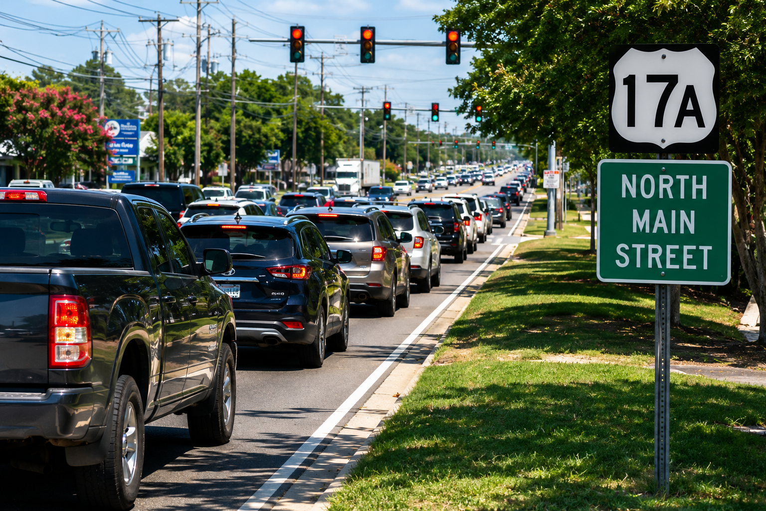
Transportation officials say worsening congestion along US 17A, also known as North Main Street, has become a growing concern as residential and commercial development continues to expand throughout the area.
“The severity of congestion and traffic safety along and around the US 17A/N. Main Street corridor in Berkeley and Dorchester counties is a constant and ever-growing concern,” BCDCOG said in a statement.
Focus on Traffic and Safety
The public meeting is part of the ongoing US 17A Corridor and Congestion Management Plan, a study aimed at identifying solutions to improve traffic flow, reduce delays and address safety issues throughout the corridor.
Residents attending the meeting will have an opportunity to review existing traffic conditions, discuss transportation challenges, provide feedback and share ideas for potential improvements with project representatives.
In addition to US 17A, planners are also evaluating traffic conditions along College Park Road and Royle Road, two heavily traveled routes that have experienced increasing congestion and safety concerns in recent years.
Study Area Covers More Than 14 Miles of Roadways
The corridor management study includes approximately 14 miles of roadways across Berkeley and Dorchester counties.
The primary US 17A study area stretches roughly 7.5 miles from U.S. Highway 78 at Fifth North Street to Cypress Gardens Road.
The plan also examines:
- Approximately 4 miles of College Park Road from US 17A/North Main Street to south of the Interstate 26 interchange in Berkeley County.
- Approximately 2.5 miles of Royle Road from US 17A/North Main Street to U.S. 78 in Berkeley County.
Transportation officials say the goal is to develop strategies that not only address today’s traffic problems but also accommodate future growth expected throughout the rapidly developing corridor.
Public Input Encouraged
BCDCOG officials are encouraging residents, commuters, business owners and anyone who regularly travels the corridor to attend the meeting and provide input.
Feedback gathered during the planning process will help guide future recommendations and transportation improvements aimed at easing congestion and improving safety throughout one of the Lowcountry’s busiest travel corridors.
Meeting Details
What: US 17A Corridor & Congestion Management Plan Public Information Meeting
When: Tuesday, June 9, from 5 p.m. to 7 p.m.
Where: Sangaree Middle School, 1050 Discovery Lane, Ladson
Hosted By: Berkeley-Charleston-Dorchester Council of Governments (BCDCOG)
Purpose: Review existing conditions, identify traffic and safety concerns, and gather public input on potential transportation improvements.


